Trail Walking Bugarach - Bugarach - Fontaine salée (La Salz) - Photo

Bugarach - Fontaine salée (La Salz)

© OpenStreetMap contributors
Length
Length
8.7 km
Max alt
Max alt
836 m
Uphill gradient
Uphill gradient
279 m
Km-Effort
Km-Effort  
12.5 km
Min alt
Min alt
701 m
Downhill gradient
Downhill gradient
288 m
Boucle
Boucle
Yes
Creation date :
2020-10-09 07:57:52.0
Updated on :
2020-10-13 17:57:04.253

(0 Reviews)

Walking
Walking
3h59
Difficulty : Medium

Scan this QR Code to open this trail in the SityTrail application

FREE GPS app for hiking

Logo SityTrail SityTrail

IGN / Geographical institutes

Download SityTrail from the App Store Download SityTrail from Google Play

Logo SityTrail SityTrail World

The world is yours!

Download SityTrail from the App Store Download SityTrail from Google Play Download SityTrail on Huawei AppGallery

About

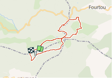
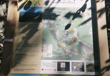
Trail Walking of 8.7 km to be discovered at Occitania, Aude, Bugarach. This trail is proposed by PiloudeBamako.

Description

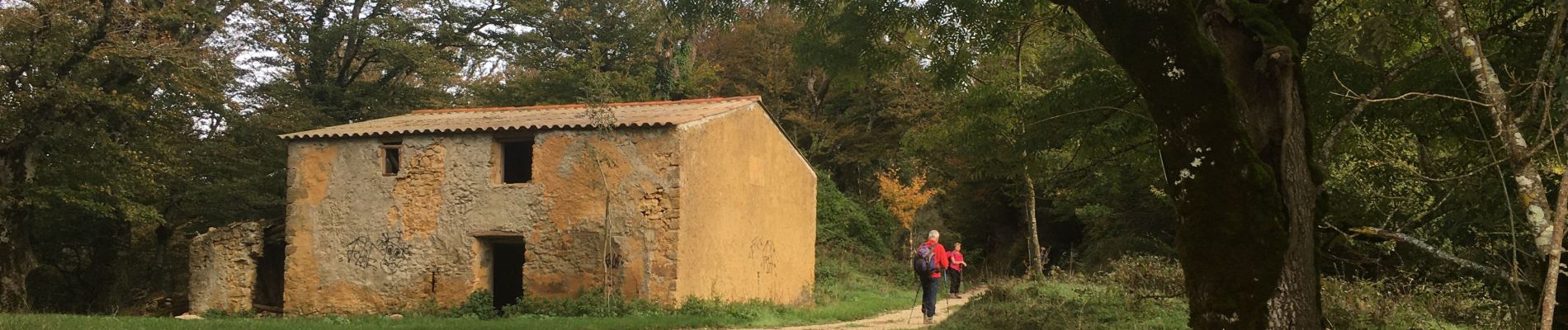
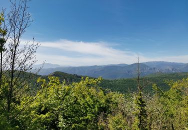
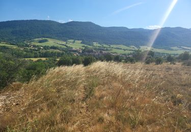
Randonnée dans la forêt.
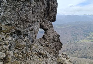
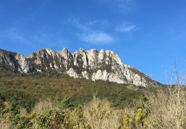
Cante-Loup; Col de la Fage; Roc de l'aigle; Fontaine salée (La Salz); Pas de Capelan.
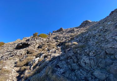
Un seul passage délicat: peu avant le 4e kilomètre, on s'écarte du ruisseau du moulin de Fourou sur la gauche pour couper à travers champs et bois et monter (pente raide dans les bois) vers le col de la Fage (chemin  effacé). Le parcours est par ailleurs facile.

Elevation profile

Photos

Positioning

Country:
France
Region :
Occitania
Department/Province :
Aude
Municipality :
Bugarach
Location:
Unknown
Start:(UTM)
450697 ; 4748557 (31T) N.

Trails nearby

Trail Walking Bugarach - Le Pech de Bugarach - Photo
Walking
tracegps

Walking

Difficult
(1)
Bugarach, Occitania, Aude, France
16.5 km | 28 km-effort
6h 15min
Yes
Trail Walking Bugarach - Le Pech de Bugarach 1230 m, depuis le Col du Linas - Photo
Walking
tracegps

Walking

Medium
(2)
Bugarach, Occitania, Aude, France
10.5 km | 20 km-effort
5h 45min
Yes
Trail Walking Bugarach - Bugarach par la fenêtre  - Photo
Walking
GUIDE
Ada11

Walking

Medium
Bugarach, Occitania, Aude, France
14.1 km | 25 km-effort
4h 31min
Yes
Trail Walking Bugarach - le Pech de Bugarach - Lac de La vène - Photo
Walking
jacques delaporte

Walking

Difficult
Bugarach, Occitania, Aude, France
9.3 km | 17.8 km-effort
6h 12min
No
Trail Walking Sougraigne - Sougraigne bugarach pont romain  - Photo
Walking
Maxime Dallaston

Walking

Difficult
Sougraigne, Occitania, Aude, France
13.8 km | 22 km-effort
4h 6min
Yes
Trail Walking Bugarach - Tour Bugarach  - Photo
Walking
GUIDE
Ada11

Walking

Medium
Bugarach, Occitania, Aude, France
16.1 km | 25 km-effort
4h 11min
Yes
Trail Walking Bugarach - Col du Linas-Pech de Bugarach-La fenêtre  - Photo
Walking
Repi Newlife

Walking

Medium
Bugarach, Occitania, Aude, France
6.2 km | 15.1 km-effort
3h 30min
No
Trail Walking Sougraigne - Source De La Sals à Sougraigne - Photo
Walking
PI11

Walking

Easy
Sougraigne, Occitania, Aude, France
14.6 km | 22 km-effort
5h 29min
Yes
Trail Walking Camps-sur-l'Agly - Pech de Bugarach (départ de la Bastide - Camps-sur-l'Agly) - Photo
Walking
PiloudeBamako

Walking

Difficult
Camps-sur-l'Agly, Occitania, Aude, France
12.7 km | 25 km-effort
6h 17min
Yes


Close
My subscriptions