


Autour de Cabasse

affinetataille
User GUIDE
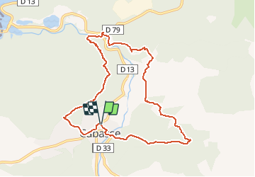

Length
9.8 km

Max alt
339 m

Uphill gradient
415 m
Km-Effort
15.4 km

Min alt
188 m

Downhill gradient
418 m
Boucle
Yes
Creation date :
2020-10-09 07:43:17.523
Updated on :
2021-01-08 18:14:04.859
6h10
Difficulty : Medium

FREE GPS app for hiking
 SityTrail
IGN / Geographical institutes
SityTrail Plus
The world is yours!
About
Trail Walking of 9.8 km to be discovered at Provence-Alpes-Côte d'Azur, Var, Cabasse. This trail is proposed by affinetataille.
Description
3 bonnes montées
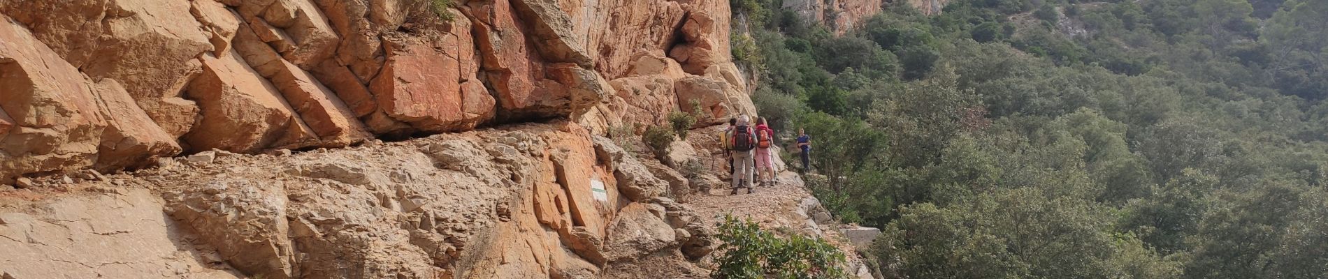
1 passage sur corniche sous les falaises (cordes en place pour se tenir)
Multiples points d'intérêts.
Belle randonnée
Photos


Positioning
Country:
France
Region :
Provence-Alpes-Côte d'Azur
Department/Province :
Var
Municipality :
Cabasse
Location:
Unknown
Start:(Dec)
Start:(UTM)
275159 ; 4812084 (32T) N.
Comments