


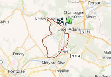
parmain auvers via abbaye du val

olivieraron
User

Length
22 km

Max alt
105 m

Uphill gradient
294 m
Km-Effort
25 km

Min alt
19 m

Downhill gradient
288 m
Boucle
Yes
Creation date :
2020-10-12 06:43:14.334
Updated on :
2020-10-12 06:43:52.114
5h34
Difficulty : Very difficult

FREE GPS app for hiking
 SityTrail
IGN / Geographical institutes
SityTrail Plus
The world is yours!
About
Trail Walking of 22 km to be discovered at Ile-de-France, Val-d'Oise, Parmain. This trail is proposed by olivieraron.
Positioning
Country:
France
Region :
Ile-de-France
Department/Province :
Val-d'Oise
Municipality :
Parmain
Location:
Unknown
Start:(Dec)
Start:(UTM)
442320 ; 5440497 (31U) N.
Comments