


Loudenvielle-Refuge d'Espingo

ARVIEU
User
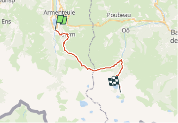

Length
19 km

Max alt
2137 m

Uphill gradient
2018 m
Km-Effort
43 km

Min alt
962 m

Downhill gradient
1096 m
Boucle
No
Creation date :
2020-10-12 19:05:23.05
Updated on :
2020-10-12 19:08:27.174
8h54
Difficulty : Very difficult

FREE GPS app for hiking
 SityTrail
IGN / Geographical institutes
SityTrail Plus
The world is yours!
About
Trail Walking of 19 km to be discovered at Occitania, Hautespyrenees, Loudenvielle. This trail is proposed by ARVIEU.
Positioning
Country:
France
Region :
Occitania
Department/Province :
Hautespyrenees
Municipality :
Loudenvielle
Location:
Loudenvielle
Start:(Dec)
Start:(UTM)
288096 ; 4741491 (31T) N.
Comments