


Fos - Refuge de lEtang d'Araing

ARVIEU
User
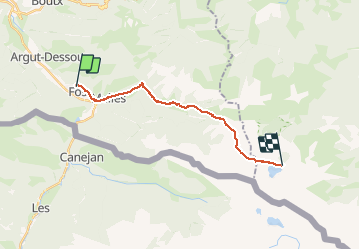

Length
16.7 km

Max alt
2204 m

Uphill gradient
1721 m
Km-Effort
35 km

Min alt
552 m

Downhill gradient
394 m
Boucle
No
Creation date :
2020-10-12 19:54:56.372
Updated on :
2020-10-12 20:00:40.428
7h42
Difficulty : Very difficult

FREE GPS app for hiking
 SityTrail
IGN / Geographical institutes
SityTrail Plus
The world is yours!
About
Trail Walking of 16.7 km to be discovered at Occitania, Haute-Garonne, Fos. This trail is proposed by ARVIEU.
Positioning
Country:
France
Region :
Occitania
Department/Province :
Haute-Garonne
Municipality :
Fos
Location:
Unknown
Start:(Dec)
Start:(UTM)
315102 ; 4749310 (31T) N.
Comments