


guay yves

Yannick.Boireau
User
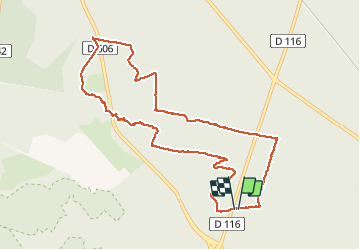

Length
9.9 km

Max alt
153 m

Uphill gradient
152 m
Km-Effort
11.9 km

Min alt
85 m

Downhill gradient
151 m
Boucle
Yes
Creation date :
2020-10-13 07:03:33.579
Updated on :
2020-10-13 09:42:46.258
2h38
Difficulty : Very easy

FREE GPS app for hiking
 SityTrail
IGN / Geographical institutes
SityTrail Plus
The world is yours!
About
Trail Walking of 9.9 km to be discovered at Ile-de-France, Seine-et-Marne, Fontainebleau. This trail is proposed by Yannick.Boireau.
Positioning
Country:
France
Region :
Ile-de-France
Department/Province :
Seine-et-Marne
Municipality :
Fontainebleau
Location:
Unknown
Start:(Dec)
Start:(UTM)
478694 ; 5364043 (31U) N.
Comments