


2020-10-13_16h27m15_COURSE_39635084

Maca8284
User
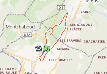

Length
6.4 km

Max alt
485 m

Uphill gradient
217 m
Km-Effort
9.3 km

Min alt
287 m

Downhill gradient
215 m
Boucle
Yes
Creation date :
2020-10-13 14:27:15.51
Updated on :
2020-10-13 16:23:58.562

FREE GPS app for hiking
 SityTrail
IGN / Geographical institutes
SityTrail Plus
The world is yours!
About
Trail of 6.4 km to be discovered at Auvergne-Rhône-Alpes, Isère, Vizille. This trail is proposed by Maca8284.
Positioning
Country:
France
Region :
Auvergne-Rhône-Alpes
Department/Province :
Isère
Municipality :
Vizille
Location:
Unknown
Start:(Dec)
Start:(UTM)
718666 ; 4995993 (31T) N.
Comments