


ubaye:depart saint ours col de maillemort

gerardmicheline
User
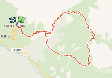

Length
13.2 km

Max alt
2557 m

Uphill gradient
788 m
Km-Effort
24 km

Min alt
1771 m

Downhill gradient
790 m
Boucle
Yes
Creation date :
2020-10-15 13:40:06.202
Updated on :
2020-10-15 13:40:58.609
4h46
Difficulty : Very difficult

FREE GPS app for hiking
 SityTrail
IGN / Geographical institutes
SityTrail Plus
The world is yours!
About
Trail Walking of 13.2 km to be discovered at Provence-Alpes-Côte d'Azur, Alpes-de-Haute-Provence, Val-d'Oronaye. This trail is proposed by gerardmicheline.
Positioning
Country:
France
Region :
Provence-Alpes-Côte d'Azur
Department/Province :
Alpes-de-Haute-Provence
Municipality :
Val-d'Oronaye
Location:
Meyronnes
Start:(Dec)
Start:(UTM)
325866 ; 4927489 (32T) N.
Comments