


coq roc arguille

lionelnottat
User
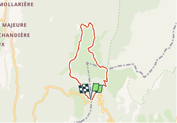

Length
6.2 km

Max alt
1769 m

Uphill gradient
366 m
Km-Effort
11 km

Min alt
1409 m

Downhill gradient
369 m
Boucle
Yes
Creation date :
2020-10-18 08:13:39.938
Updated on :
2020-10-18 11:35:18.551
3h21
Difficulty : Very easy

FREE GPS app for hiking
 SityTrail
IGN / Geographical institutes
SityTrail Plus
The world is yours!
About
Trail Walking of 6.2 km to be discovered at Auvergne-Rhône-Alpes, Isère, Saint-Pierre-de-Chartreuse. This trail is proposed by lionelnottat.
Positioning
Country:
France
Region :
Auvergne-Rhône-Alpes
Department/Province :
Isère
Municipality :
Saint-Pierre-de-Chartreuse
Location:
Unknown
Start:(Dec)
Start:(UTM)
722369 ; 5020493 (31T) N.
Comments