


tour de l echarasson

bymarc26
User

Length
9.9 km

Max alt
1165 m

Uphill gradient
358 m
Km-Effort
14.7 km

Min alt
849 m

Downhill gradient
359 m
Boucle
Yes
Creation date :
2020-10-18 09:21:27.968
Updated on :
2020-10-18 12:40:10.291
2h21
Difficulty : Easy

FREE GPS app for hiking
 SityTrail
IGN / Geographical institutes
SityTrail Plus
The world is yours!
About
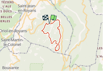
Trail Walking of 9.9 km to be discovered at Auvergne-Rhône-Alpes, Drôme, Saint-Jean-en-Royans. This trail is proposed by bymarc26.
Description
parfait pour une 1/2 journée
Positioning
Country:
France
Region :
Auvergne-Rhône-Alpes
Department/Province :
Drôme
Municipality :
Saint-Jean-en-Royans
Location:
Unknown
Start:(Dec)
Start:(UTM)
682667 ; 4985845 (31T) N.
Comments