


Rebouc G4

LouisROGER
User GUIDE
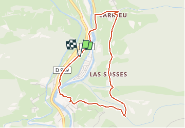

Length
4.4 km

Max alt
697 m

Uphill gradient
112 m
Km-Effort
5.9 km

Min alt
583 m

Downhill gradient
112 m
Boucle
Yes
Creation date :
2020-10-18 13:49:31.179
Updated on :
2020-10-18 18:18:23.257
1h10
Difficulty : Very easy
1h00
Difficulty : Very easy

FREE GPS app for hiking
 SityTrail
IGN / Geographical institutes
SityTrail Plus
The world is yours!
About
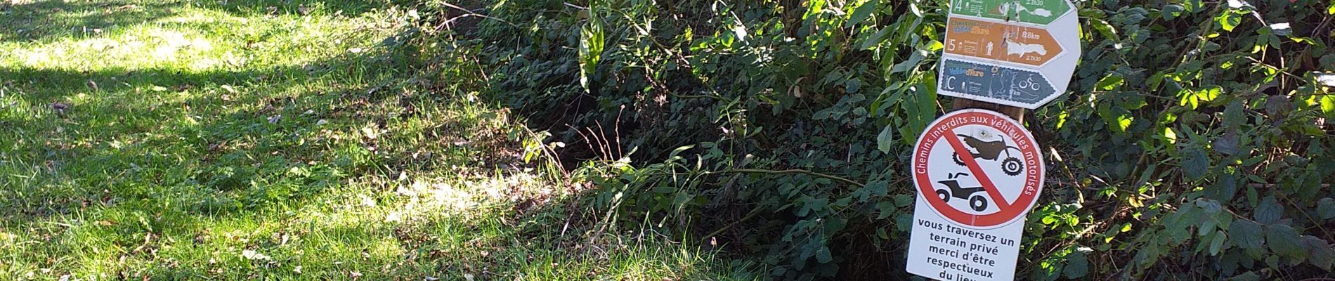
Trail Walking of 4.4 km to be discovered at Occitania, Hautespyrenees, Hèches. This trail is proposed by LouisROGER.
Description
jolie petite promenade sans aucune difficulté!
Photos


Positioning
Country:
France
Region :
Occitania
Department/Province :
Hautespyrenees
Municipality :
Hèches
Location:
Unknown
Start:(Dec)
Start:(UTM)
286244 ; 4764284 (31T) N.
Comments