


Grand bois de fayards

pb07
User

Length
6.4 km

Max alt
1062 m

Uphill gradient
282 m
Km-Effort
10.1 km

Min alt
773 m

Downhill gradient
281 m
Boucle
Yes
Creation date :
2020-10-18 13:03:22.172
Updated on :
2020-10-18 16:27:18.082
2h01
Difficulty : Easy

FREE GPS app for hiking
 SityTrail
IGN / Geographical institutes
SityTrail Plus
The world is yours!
About
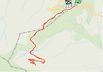
Trail Walking of 6.4 km to be discovered at Auvergne-Rhône-Alpes, Ardèche, Jaujac. This trail is proposed by pb07.
Positioning
Country:
France
Region :
Auvergne-Rhône-Alpes
Department/Province :
Ardèche
Municipality :
Jaujac
Location:
Unknown
Start:(Dec)
Start:(UTM)
598585 ; 4940041 (31T) N.
Comments