Equine, déversoir et lac de l'Avelan

LEDUNC
User
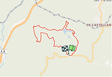

Length
8.3 km

Max alt
314 m

Uphill gradient
264 m
Km-Effort
11.8 km

Min alt
79 m

Downhill gradient
264 m
Boucle
Yes
Creation date :
2020-10-19 08:32:37.129
Updated on :
2020-10-19 10:26:12.854
1h44
Difficulty : Very easy

FREE GPS app for hiking
 SityTrail
IGN / Geographical institutes
SityTrail Plus
The world is yours!
About
Trail Walking of 8.3 km to be discovered at Provence-Alpes-Côte d'Azur, Var, Fréjus. This trail is proposed by LEDUNC.
Description
Beaux endroits et belles vues
Positioning
Country:
France
Region :
Provence-Alpes-Côte d'Azur
Department/Province :
Var
Municipality :
Fréjus
Location:
Unknown
Start:(Dec)
Start:(UTM)
321617 ; 4818943 (32T) N.
Comments