


partie du sentier de guinefort

Pieeet
User

Length
4.5 km

Max alt
83 m

Uphill gradient
31 m
Km-Effort
4.9 km

Min alt
68 m

Downhill gradient
36 m
Boucle
Yes
Creation date :
2020-10-20 15:47:36.108
Updated on :
2020-10-20 16:47:27.732
57m
Difficulty : Very easy

FREE GPS app for hiking
 SityTrail
IGN / Geographical institutes
SityTrail Plus
The world is yours!
About
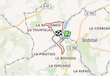
Trail Walking of 4.5 km to be discovered at Brittany, Côtes-d'Armor, Brusvily. This trail is proposed by Pieeet.
Description
Jolie balade boisée autour de lacs
Positioning
Country:
France
Region :
Brittany
Department/Province :
Côtes-d'Armor
Municipality :
Brusvily
Location:
Unknown
Start:(Dec)
Start:(UTM)
565306 ; 5362646 (30U) N.
Comments