


Chaudes Aigues - Sansard

neitag61
User
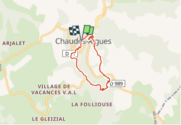

Length
5.1 km

Max alt
927 m

Uphill gradient
182 m
Km-Effort
7.5 km

Min alt
754 m

Downhill gradient
182 m
Boucle
Yes
Creation date :
2020-10-21 14:47:03.035
Updated on :
2020-10-21 14:50:03.41
1h33
Difficulty : Medium

FREE GPS app for hiking
 SityTrail
IGN / Geographical institutes
SityTrail Plus
The world is yours!
About
Trail Walking of 5.1 km to be discovered at Auvergne-Rhône-Alpes, Cantal, Chaudes-Aigues. This trail is proposed by neitag61.
Description
Joli Circuit
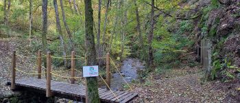
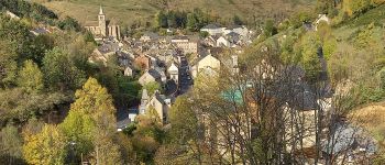
Photos


Positioning
Country:
France
Region :
Auvergne-Rhône-Alpes
Department/Province :
Cantal
Municipality :
Chaudes-Aigues
Location:
Unknown
Start:(Dec)
Start:(UTM)
500310 ; 4966648 (31T) N.
Comments