


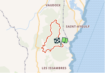
LES ISSAMBRES - LE VALLON DE LA GAILLARDE

jean-marie.parachini
User


4h39
Difficulty : Easy

FREE GPS app for hiking
 SityTrail
IGN / Geographical institutes
SityTrail Plus
The world is yours!
About
Trail Walking of 11.1 km to be discovered at Provence-Alpes-Côte d'Azur, Var, Roquebrune-sur-Argens. This trail is proposed by jean-marie.parachini.
Description
randonnée avec des panoramas sur le golfe de Fréjus les étangs de Villepey et Roquebrunes jusqu'au sommets de l'Esterel.
Photos


21 photos in total. Please click on a photo to see them all in the gallery.
Positioning
Comments