


MAULEON BARROUSSE-Mauléon/Esbareich - G4 -TC- fait le 23/10/2020

mitch1952
User
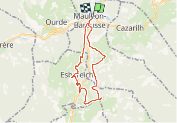

Length
7.8 km

Max alt
799 m

Uphill gradient
291 m
Km-Effort
11.7 km

Min alt
573 m

Downhill gradient
291 m
Boucle
Yes
Creation date :
2020-10-23 07:55:04.127
Updated on :
2022-06-07 12:40:39.287
5h00
Difficulty : Very easy

FREE GPS app for hiking
 SityTrail
IGN / Geographical institutes
SityTrail Plus
The world is yours!
About
Trail Walking of 7.8 km to be discovered at Occitania, Hautespyrenees, Mauléon-Barousse. This trail is proposed by mitch1952.
Description
Jolie balade dans la Barrousse. Aire de PN au point culminant. Au km 5 sentier pas évident, contourner l'enclos à cochon par la gauche.
Positioning
Country:
France
Region :
Occitania
Department/Province :
Hautespyrenees
Municipality :
Mauléon-Barousse
Location:
Unknown
Start:(Dec)
Start:(UTM)
301681 ; 4759232 (31T) N.
Comments