Trail Walking Saint-Raphaël - Dent de l'Ours dans L'Esterel - Photo

Dent de l'Ours dans L'Esterel

 Sugg
Sugg

User

© OpenStreetMap contributors
Length
Length
19.2 km
Max alt
Max alt
388 m
Uphill gradient
Uphill gradient
496 m
Km-Effort
Km-Effort  
26 km
Min alt
Min alt
28 m
Downhill gradient
Downhill gradient
496 m
Boucle
Boucle
Yes
Creation date :
2019-03-22 17:00:15.893
Updated on :
2019-03-22 17:00:16.059

(0 Reviews)

Walking
Walking
6h05
Difficulty : Difficult

Scan this QR Code to open this trail in the SityTrail application

FREE GPS app for hiking

Logo SityTrail SityTrail

IGN / Geographical institutes

Download SityTrail from the App Store Download SityTrail from Google Play

Logo SityTrail SityTrail World

The world is yours!

Download SityTrail from the App Store Download SityTrail from Google Play Download SityTrail on Huawei AppGallery

About

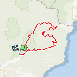
Trail Walking of 19.2 km to be discovered at Provence-Alpes-Côte d'Azur, Var, Saint-Raphaël. This trail is proposed by Sugg.

Description

19-03-2014.
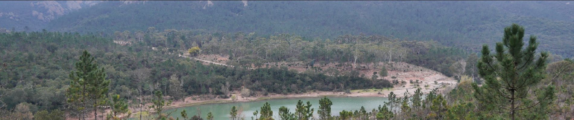
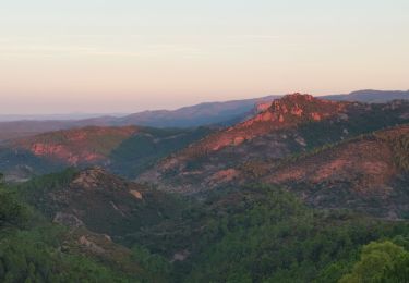
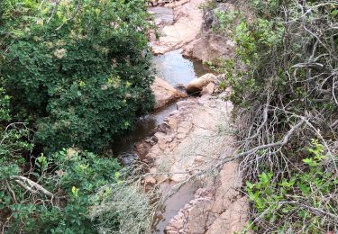
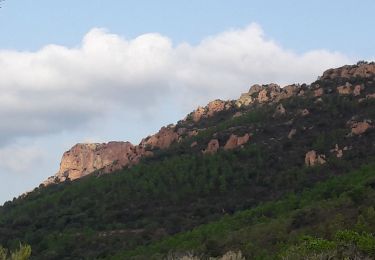
Rando dans l’Estérel au sein du club Restons en forme sous la " baguette " de Pierre. La météo n'étant pas très clémente le matin, nous ne sommes pas allés au Pic d'Aurelle ni au pic de l'Ours plongés dans la brume et donc sans intérêt pour le point de vue.Nous n'avons vu ni la queue ni le lac de l’écureuil vidé de son eau .... nul....autrement, super tour de 19kms.

Elevation profile

Photos

Positioning

Country:
France
Region :
Provence-Alpes-Côte d'Azur
Department/Province :
Var
Municipality :
Saint-Raphaël
Location:
Unknown
Start:(UTM)
327553 ; 4813766 (32T) N.

Trails nearby

Trail Walking Saint-Raphaël - Massif d'ésterel-grande boucle pic cap roux - Photo
Walking
jeromelacoste

Walking

Medium
(2)
Saint-Raphaël, Provence-Alpes-Côte d'Azur, Var, France
10.4 km | 17.5 km-effort
2h 58min
Yes
Trail Walking Saint-Raphaël - Les lacs par les rochers du Caneiret - Photo
Walking
ETMU5496

Walking

Medium
(1)
Saint-Raphaël, Provence-Alpes-Côte d'Azur, Var, France
20 km | 29 km-effort
5h 7min
Yes
Trail Walking Saint-Raphaël - Le tour du Pic du Cap Roux - St Raphaël (Agay) - Photo
Walking
tracegps

Walking

Medium
(2)
Saint-Raphaël, Provence-Alpes-Côte d'Azur, Var, France
7.2 km | 12.8 km-effort
2h 0min
Yes
Trail Walking Saint-Raphaël - Pic du Cap Roux - Photo
Walking
Kilroy06

Walking

Very easy
(4)
Saint-Raphaël, Provence-Alpes-Côte d'Azur, Var, France
4.1 km | 7.8 km-effort
1h 17min
Yes
Trail Walking Saint-Raphaël - Agay - Sainte-Barbe - Étang des Nénuphares - Photo
Walking
E.BURCK

Walking

Easy
(2)
Saint-Raphaël, Provence-Alpes-Côte d'Azur, Var, France
5 km | 6.2 km-effort
2h 8min
Yes
Trail Walking Saint-Raphaël - Tour du Pic de l'Ours - Le Trayas - Photo
Walking
tracegps

Walking

Medium
(1)
Saint-Raphaël, Provence-Alpes-Côte d'Azur, Var, France
9.5 km | 16 km-effort
3h 0min
Yes
Trail Mountain bike Saint-Raphaël - activity_9094673788 - Photo
Mountain bike
GUIDE
pascalou73

Mountain bike

Medium
Saint-Raphaël, Provence-Alpes-Côte d'Azur, Var, France
19.6 km | 25 km-effort
1h 42min
Yes
Trail Mountain bike Saint-Raphaël - activity_9094242808 - Photo
Mountain bike
GUIDE
pascalou73

Mountain bike

Medium
Saint-Raphaël, Provence-Alpes-Côte d'Azur, Var, France
22 km | 29 km-effort
1h 59min
Yes
Trail Mountain bike Saint-Raphaël - activity_9082592241 - Photo
Mountain bike
GUIDE
pascalou73

Mountain bike

Very difficult
Saint-Raphaël, Provence-Alpes-Côte d'Azur, Var, France
34 km | 45 km-effort
3h 6min
Yes


Close
My subscriptions