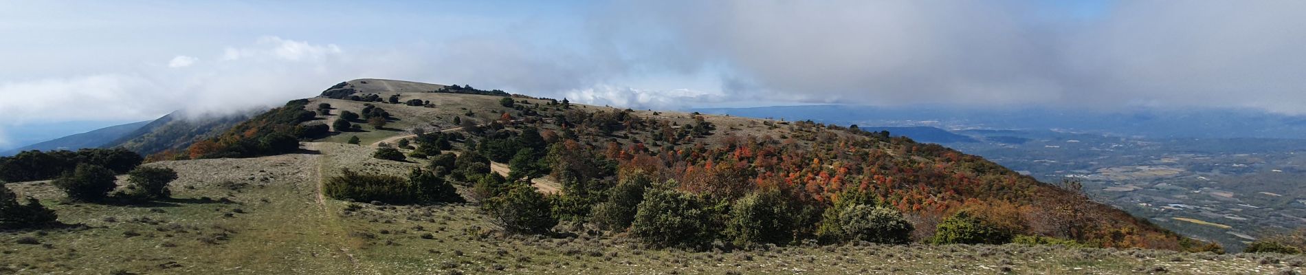
Trail Walking Cabrières-d'Aigues - le Mourre Nègre - Photo
 amiral13
amiral13

User GUIDE

© OpenStreetMap contributors
Length
Length
15.7 km
Max alt
Max alt
1121 m
Uphill gradient
Uphill gradient
807 m
Km-Effort
Km-Effort  
26 km
Min alt
Min alt
419 m
Downhill gradient
Downhill gradient
809 m
Boucle
Boucle
Yes
Creation date :
2020-10-24 07:50:34.984
Updated on :
2020-10-25 11:33:56.73

(0 Reviews)

Walking
Walking
6h34
Difficulty : Medium

Scan this QR Code to open this trail in the SityTrail application

FREE GPS app for hiking

Logo SityTrail SityTrail

IGN / Geographical institutes

Download SityTrail from the App Store Download SityTrail from Google Play

Logo SityTrail SityTrail Plus

The world is yours!

Download SityTrail from the App Store Download SityTrail from Google Play Download SityTrail on Huawei AppGallery

About

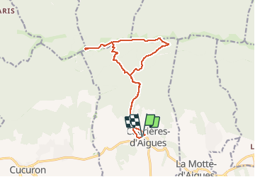
Trail Walking of 15.7 km to be discovered at Provence-Alpes-Côte d'Azur, Vaucluse, Cabrières-d'Aigues. This trail is proposed by amiral13.

Description

Une belle randonnée à faire en automne pour les couleurs, mais attention aux chasseurs en cette saison.
lorsque l'on débouche sur la crête on a l'impression de de se retrouver en montagne.
Attention le parking qui figure sur la carte IGN à l'ouest du village est privé; Il faudra donc trouver un autre lieu de stationnement à l'intérieur du village. Hors de la période estivale on pourra même se stationner à un petit kilometre du village au niveau de la barrière DFCI.

Elevation profile

Photos

Positioning

Country:
France
Region :
Provence-Alpes-Côte d'Azur
Department/Province :
Vaucluse
Municipality :
Cabrières-d'Aigues
Location:
Unknown
Start:(UTM)
700761 ; 4850967 (31T) N.


Close
My subscriptions