Trail Walking Pranles - Le bilan des chinoises- mise à jour  - Photo

Le bilan des chinoises- mise à jour

 prv
prv

User

© OpenStreetMap contributors
Length
Length
11.6 km
Max alt
Max alt
729 m
Uphill gradient
Uphill gradient
548 m
Km-Effort
Km-Effort  
18.9 km
Min alt
Min alt
372 m
Downhill gradient
Downhill gradient
547 m
Boucle
Boucle
Yes
Creation date :
2020-10-28 11:49:34.08
Updated on :
2020-10-28 15:55:28.145

(0 Reviews)

Walking
Walking
3h09
Difficulty : Medium

Scan this QR Code to open this trail in the SityTrail application

FREE GPS app for hiking

Logo SityTrail SityTrail

IGN / Geographical institutes

Download SityTrail from the App Store Download SityTrail from Google Play

Logo SityTrail SityTrail World

The world is yours!

Download SityTrail from the App Store Download SityTrail from Google Play Download SityTrail on Huawei AppGallery

About

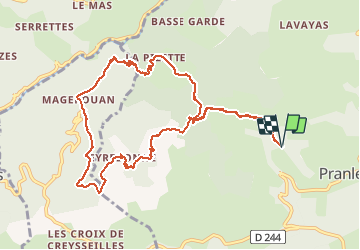
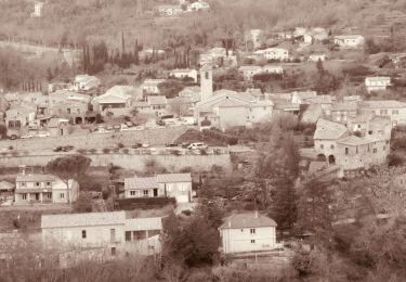
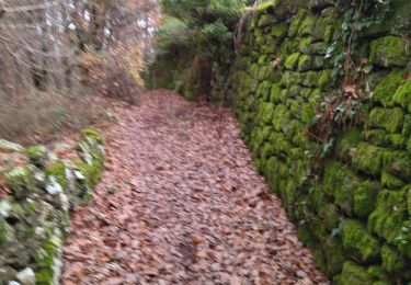
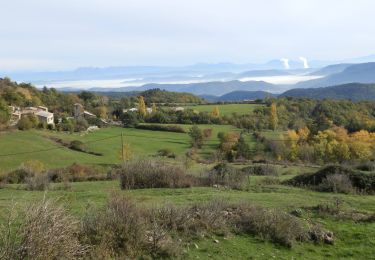
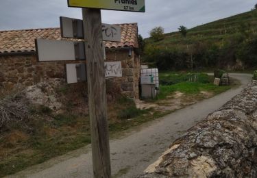
Trail Walking of 11.6 km to be discovered at Auvergne-Rhône-Alpes, Ardèche, Pranles. This trail is proposed by prv.

Description

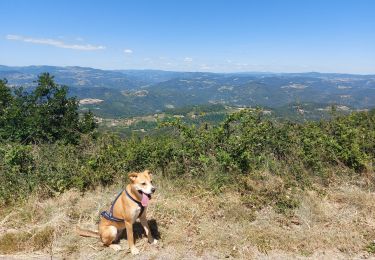
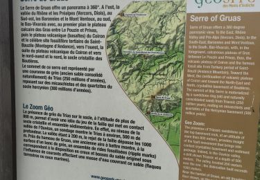
ballade dans les châtaignes et sur le volcan

Elevation profile

Photos

Positioning

Country:
France
Region :
Auvergne-Rhône-Alpes
Department/Province :
Ardèche
Municipality :
Pranles
Location:
Unknown
Start:(UTM)
623733 ; 4959181 (31T) N.

Trails nearby

Trail Walking Pranles - La Pizette Magerouan Le Chier 14KM - Photo
Walking
GUIDE
thonyc

Walking

Very difficult
Pranles, Auvergne-Rhône-Alpes, Ardèche, France
15.4 km | 25 km-effort
5h 43min
Yes
Trail Walking Coux - Coux Serre Gruas 19km - Photo
Walking
GUIDE
thonyc

Walking

Medium
Coux, Auvergne-Rhône-Alpes, Ardèche, France
19.4 km | 29 km-effort
5h 25min
Yes
Trail Walking Coux - w-frankrijk-wandelroute-coux-ardeche - Photo
Walking
gpstracks

Walking

Very easy
(1)
Coux, Auvergne-Rhône-Alpes, Ardèche, France
5.8 km | 9.3 km-effort
Unknown
Yes
Trail Walking Coux - Coux 10km - Photo
Walking
GUIDE
thonyc

Walking

Medium
Coux, Auvergne-Rhône-Alpes, Ardèche, France
10.4 km | 16.1 km-effort
3h 0min
Yes
Trail Walking Lyas - 07 privas Livier zel - Photo
Walking
himba26100

Walking

Medium
Lyas, Auvergne-Rhône-Alpes, Ardèche, France
18.1 km | 28 km-effort
6h 46min
Yes
Trail Walking Pourchères - Pourcheres 14km - Photo
Walking
GUIDE
thonyc

Walking

Medium
Pourchères, Auvergne-Rhône-Alpes, Ardèche, France
14.1 km | 21 km-effort
4h 0min
Yes
Trail Walking Pranles - 07 chirouze prandes - Photo
Walking
himba26100

Walking

Easy
Pranles, Auvergne-Rhône-Alpes, Ardèche, France
11.3 km | 17.6 km-effort
5h 12min
No
Trail Walking Saint-Vincent-de-Durfort - croix de grua - Photo
Walking
lucharley

Walking

Very difficult
Saint-Vincent-de-Durfort, Auvergne-Rhône-Alpes, Ardèche, France
16.2 km | 25 km-effort
5h 37min
No
Trail Walking Les Ollières-sur-Eyrieux - Serré de Gruas  - Photo
Walking
ajd26

Walking

Easy
Les Ollières-sur-Eyrieux, Auvergne-Rhône-Alpes, Ardèche, France
16.8 km | 27 km-effort
4h 51min
Yes


Close
My subscriptions