


Le bilan des chinoises- mise à jour

prv
User
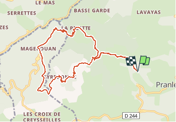

Length
11.6 km

Max alt
729 m

Uphill gradient
548 m
Km-Effort
18.9 km

Min alt
372 m

Downhill gradient
547 m
Boucle
Yes
Creation date :
2020-10-28 11:49:34.08
Updated on :
2020-10-28 15:55:28.145
3h09
Difficulty : Medium

FREE GPS app for hiking
 SityTrail
IGN / Geographical institutes
SityTrail Plus
The world is yours!
About
Trail Walking of 11.6 km to be discovered at Auvergne-Rhône-Alpes, Ardèche, Pranles. This trail is proposed by prv.
Description
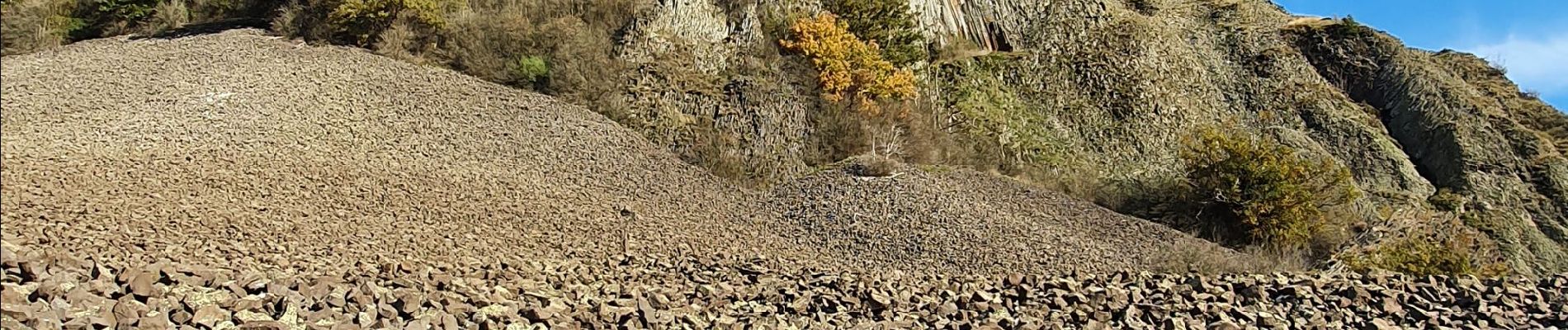
ballade dans les châtaignes et sur le volcan
Photos


Positioning
Country:
France
Region :
Auvergne-Rhône-Alpes
Department/Province :
Ardèche
Municipality :
Pranles
Location:
Unknown
Start:(Dec)
Start:(UTM)
623733 ; 4959181 (31T) N.
Comments