


De Cipieres au plateau de Cavillore

GrouGary
User
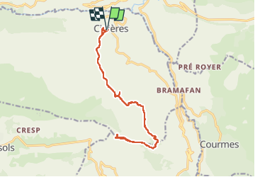

Length
17.9 km

Max alt
1249 m

Uphill gradient
625 m
Km-Effort
26 km

Min alt
763 m

Downhill gradient
626 m
Boucle
Yes
Creation date :
2020-10-29 07:38:48.442
Updated on :
2022-07-31 11:06:12.899
5h11
Difficulty : Easy

FREE GPS app for hiking
 SityTrail
IGN / Geographical institutes
SityTrail Plus
The world is yours!
About
Trail Walking of 17.9 km to be discovered at Provence-Alpes-Côte d'Azur, Maritime Alps, Cipières. This trail is proposed by GrouGary.
Description
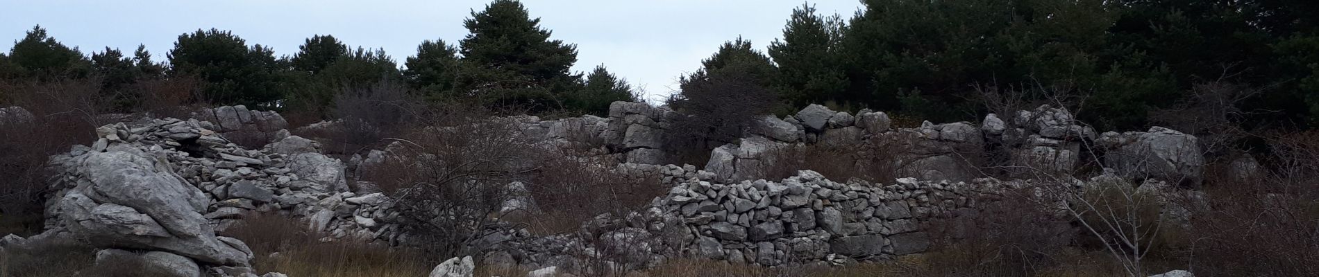
Longue randonnée/Balade sans grosses montées ou difficultés. En terrain découvert et caillouteux ou boisé. Nombreuses traces d'activités pastorales humaines (bories, murets...) ;
Photos


Positioning
Country:
France
Region :
Provence-Alpes-Côte d'Azur
Department/Province :
Maritime Alps
Municipality :
Cipières
Location:
Unknown
Start:(Dec)
Start:(UTM)
335402 ; 4849774 (32T) N.
Comments