Trail Horseback riding Hunspach - SityTrail - Boucle Hunspach - Seebach - Photo

SityTrail - Boucle Hunspach - Seebach

Promouvoir le Tourisme Equestre en Alsace GUIDE+

© OpenStreetMap contributors
Length
Length
19.8 km
Max alt
Max alt
190 m
Uphill gradient
Uphill gradient
218 m
Km-Effort
Km-Effort  
23 km
Min alt
Min alt
137 m
Downhill gradient
Downhill gradient
219 m
Boucle
Boucle
Yes
Creation date :
2020-10-29 16:46:35.346
Updated on :
2021-03-19 14:36:08.656

(1 Reviews)

Horseback riding
Horseback riding
2h53
Difficulty : Medium
Coupling
Coupling
--
Difficulty : Very easy

Scan this QR Code to open this trail in the SityTrail application

FREE GPS app for hiking

Logo SityTrail SityTrail

IGN / Geographical institutes

Download SityTrail from the App Store Download SityTrail from Google Play

Logo SityTrail SityTrail World

The world is yours!

Download SityTrail from the App Store Download SityTrail from Google Play Download SityTrail on Huawei AppGallery

About

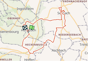
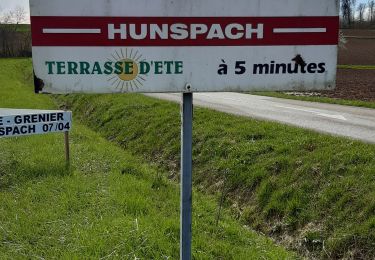
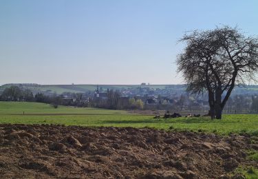
Trail Horseback riding of 19.8 km to be discovered at Grand Est, Bas-Rhin, Hunspach. This trail is proposed by Tourisme Equestre Alsace.

Description

Viste de 2 magnifiques villages alsaciens. Parking devant les terrains de tennis d'Hunspach. Pause à l'aire de pique-nique en contrebas du terrain de foot du Seebach. Pas de barres d'attache mais possibilité d'attacher autour de l'aire de pique-nique.

Elevation profile

Photos

Positioning

Country:
France
Region :
Grand Est
Department/Province :
Bas-Rhin
Municipality :
Hunspach
Location:
Unknown
Start:(UTM)
422528 ; 5422520 (32U) N.

Comments

Please log in to post a review or rate the element


Plutôt pour les calèches,beaucoup de route ou de cailloux


Trails nearby

Trail Mountain bike Soultz-sous-Forêts - 45 km VTT randonnée de l outre forêt  2012 - Photo
Mountain bike
ggseb84

Mountain bike

Very easy
Soultz-sous-Forêts, Grand Est, Bas-Rhin, France
46 km | 61 km-effort
4h 52min
Yes
Trail Walking Drachenbronn-Birlenbach - Tour du Birlenbach - Photo
Walking
LUTZMarc

Walking

Easy
Drachenbronn-Birlenbach, Grand Est, Bas-Rhin, France
17.1 km | 20 km-effort
3h 54min
Yes
Trail Walking Soultz-sous-Forêts - Le sentier des cimes depuis Soultz - Photo
Walking
Claudele

Walking

Difficult
Soultz-sous-Forêts, Grand Est, Bas-Rhin, France
26 km | 33 km-effort
7h 31min
Yes
Trail Walking Hunspach - Vosges du Nord: La ligne Maginot et Hunspach - Photo
Walking
MathieuBourgois

Walking

Difficult
Hunspach, Grand Est, Bas-Rhin, France
12.7 km | 15.3 km-effort
3h 28min
Yes
Trail Mountain bike Soultz-sous-Forêts - rando vtt soultz 2012 - Photo
Mountain bike
reymuben

Mountain bike

Difficult
Soultz-sous-Forêts, Grand Est, Bas-Rhin, France
46 km | 62 km-effort
3h 13min
Yes
Trail Equestrian Seebach - seebach - schoenenbourg -bremmelbach-steinseltz -seebach - Photo
Equestrian
jo40

Equestrian

Medium
Seebach, Grand Est, Bas-Rhin, France
30 km | 36 km-effort
5h 46min
Yes
Trail Mountain bike Soultz-sous-Forêts - rando vtt soultz 2011 - Photo
Mountain bike
reymuben

Mountain bike

Difficult
Soultz-sous-Forêts, Grand Est, Bas-Rhin, France
44 km | 59 km-effort
3h 46min
No
Trail Walking Ingolsheim - Fort de Schoenenbourg - Photo
Walking
MAD-CVW

Walking

Medium
Ingolsheim, Grand Est, Bas-Rhin, France
8.2 km | 9.8 km-effort
1h 35min
No
Trail Walking Schœnenbourg - Schoenenbourg - Rechtschwiller - Photo
Walking
MAD-CVW

Walking

Easy
Schœnenbourg, Grand Est, Bas-Rhin, France
4.3 km | 5.2 km-effort
1h 14min
Yes


Close
My subscriptions