


Crête de Bauroux

papajp
User
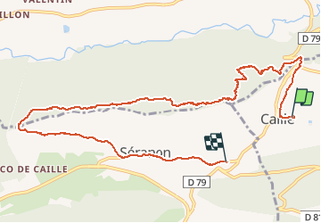

Length
11.7 km

Max alt
1630 m

Uphill gradient
584 m
Km-Effort
19.4 km

Min alt
1105 m

Downhill gradient
551 m
Boucle
No
Creation date :
2020-10-29 09:14:40.0
Updated on :
2020-10-30 12:24:04.257
6h54
Difficulty : Medium

FREE GPS app for hiking
 SityTrail
IGN / Geographical institutes
SityTrail Plus
The world is yours!
About
Trail Walking of 11.7 km to be discovered at Provence-Alpes-Côte d'Azur, Maritime Alps, Caille. This trail is proposed by papajp.
Description
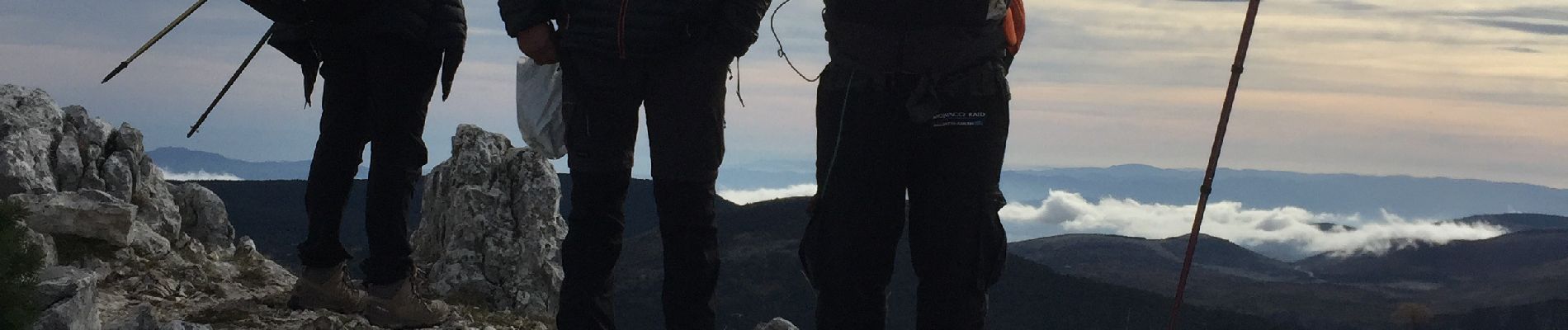
Rando en crête panorama superbe
Photos


Positioning
Country:
France
Region :
Provence-Alpes-Côte d'Azur
Department/Province :
Maritime Alps
Municipality :
Caille
Location:
Unknown
Start:(Dec)
Start:(UTM)
317522 ; 4849848 (32T) N.
Comments