


Kautenbch en boucle

MathieuBourgois
User
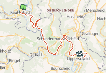

Length
14.8 km

Max alt
447 m

Uphill gradient
595 m
Km-Effort
22 km

Min alt
234 m

Downhill gradient
412 m
Boucle
No
Creation date :
2020-11-04 17:11:10.787
Updated on :
2020-11-04 17:11:42.517
--
Difficulty : Medium

FREE GPS app for hiking
 SityTrail
IGN / Geographical institutes
SityTrail Plus
The world is yours!
About
Trail On foot of 14.8 km to be discovered at Unknown, Canton Wiltz, Kiischpelt. This trail is proposed by MathieuBourgois.
Positioning
Country:
Luxembourg
Region :
Unknown
Department/Province :
Canton Wiltz
Municipality :
Kiischpelt
Location:
Unknown
Start:(Dec)
Start:(UTM)
285980 ; 5537490 (32U) N.
Comments