


MALEFOUGASSE La Ronde des Jas , Jas Figuiere , Aubert , L Ami , Calais , Trou Redon etc o

RobinMicheline
User GUIDE
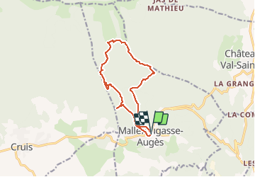

Length
13.2 km

Max alt
1204 m

Uphill gradient
543 m
Km-Effort
20 km

Min alt
694 m

Downhill gradient
546 m
Boucle
Yes
Creation date :
2020-11-06 06:22:42.482
Updated on :
2020-11-06 14:48:05.554
4h23
Difficulty : Medium

FREE GPS app for hiking
 SityTrail
IGN / Geographical institutes
SityTrail Plus
The world is yours!
About
Trail Walking of 13.2 km to be discovered at Provence-Alpes-Côte d'Azur, Alpes-de-Haute-Provence, Mallefougasse-Augès. This trail is proposed by RobinMicheline.
Description
Belle rando
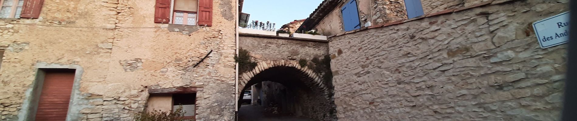
Photos


21 photos in total. Please click on a photo to see them all in the gallery.
Positioning
Country:
France
Region :
Provence-Alpes-Côte d'Azur
Department/Province :
Alpes-de-Haute-Provence
Municipality :
Mallefougasse-Augès
Location:
Mallefougasse
Start:(Dec)
Start:(UTM)
732174 ; 4883382 (31T) N.
Comments
belle rando