Trail Walking Susville - Pierre Plantée depuis les Merlins - Photo

Pierre Plantée depuis les Merlins

 cmarit
cmarit

User

© OpenStreetMap contributors
Length
Length
9.9 km
Max alt
Max alt
1547 m
Uphill gradient
Uphill gradient
431 m
Km-Effort
Km-Effort  
15.7 km
Min alt
Min alt
1210 m
Downhill gradient
Downhill gradient
426 m
Boucle
Boucle
Yes
Creation date :
2020-11-08 12:37:10.883
Updated on :
2020-11-08 12:42:17.033

(0 Reviews)

Walking
Walking
3h14
Difficulty : Medium

Scan this QR Code to open this trail in the SityTrail application

FREE GPS app for hiking

Logo SityTrail SityTrail

IGN / Geographical institutes

Download SityTrail from the App Store Download SityTrail from Google Play

Logo SityTrail SityTrail World

The world is yours!

Download SityTrail from the App Store Download SityTrail from Google Play Download SityTrail on Huawei AppGallery

About

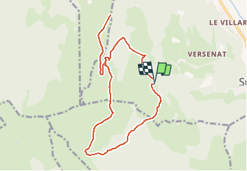
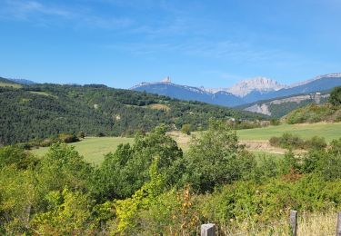
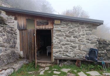
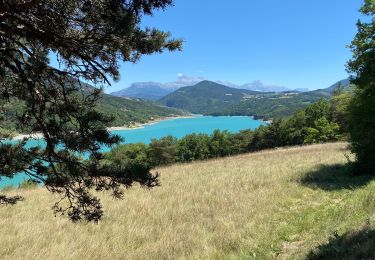
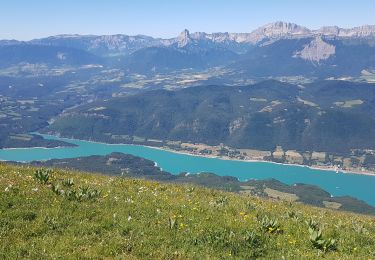
Trail Walking of 9.9 km to be discovered at Auvergne-Rhône-Alpes, Isère, Susville. This trail is proposed by cmarit.

Description

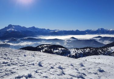
Proposition à faire pourquoi pas en raquettes ?
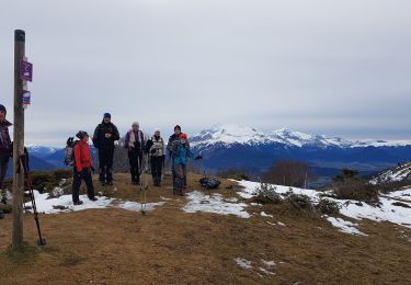
Tracé proposé après avoir fait la sortie appelée
Sénépy sans le Sénépy

Elevation profile

Positioning

Country:
France
Region :
Auvergne-Rhône-Alpes
Department/Province :
Isère
Municipality :
Susville
Location:
Unknown
Start:(UTM)
717515 ; 4977488 (31T) N.

Trails nearby

Trail Road bike La Mure - La Mure les 4 lacs - Photo
Road bike
Uio73

Road bike

Medium
(1)
La Mure, Auvergne-Rhône-Alpes, Isère, France
58 km | 72 km-effort
4h 22min
Yes
Trail Walking Mayres-Savel - Passerelles Hymalayene  Mayres + 250 - Photo
Walking
claude nier

Walking

Medium
Mayres-Savel, Auvergne-Rhône-Alpes, Isère, France
4.9 km | 8.2 km-effort
1h 59min
Yes
Trail Walking Susville - Susville les Merlins boucle par le col du Sénépiy - Photo
Walking
gmtrando

Walking

Medium
Susville, Auvergne-Rhône-Alpes, Isère, France
10.1 km | 16.3 km-effort
3h 30min
Yes
Trail Walking Mayres-Savel - Randonnée des passerelles  - Photo
Walking
choubaka77

Walking

Easy
Mayres-Savel, Auvergne-Rhône-Alpes, Isère, France
11.9 km | 17.9 km-effort
4h 51min
No
Trail Walking La Motte-Saint-Martin - Sinepi  - Photo
Walking
marc vitoria

Walking

(1)
La Motte-Saint-Martin, Auvergne-Rhône-Alpes, Isère, France
24 km | 40 km-effort
6h 0min
No
Trail Mountain bike La Motte-d'Aveillans - Le Sénépy depuis Les Signaraux - Photo
Mountain bike
patjobou

Mountain bike

Medium
La Motte-d'Aveillans, Auvergne-Rhône-Alpes, Isère, France
20 km | 32 km-effort
3h 39min
Yes
Trail Walking La Motte-d'Aveillans - Col du Sénépy et Pierre Plantée depuis les Signaraux - Photo
Walking
GuyVachet

Walking

Medium
La Motte-d'Aveillans, Auvergne-Rhône-Alpes, Isère, France
10.2 km | 15.8 km-effort
5h 39min
Yes
Trail Trail Prunières - Trail du 3ème Poste  - Photo
Trail
phd04

Trail

Medium
Prunières, Auvergne-Rhône-Alpes, Isère, France
17.7 km | 28 km-effort
2h 33min
No
Trail Walking La Motte-d'Aveillans - Les Signaraux - La Pierre Plantée  - Le Serre de L'Horizon - Le Col du Sénépy - Photo
Walking
patjobou

Walking

Easy
La Motte-d'Aveillans, Auvergne-Rhône-Alpes, Isère, France
8.7 km | 14.3 km-effort
2h 48min
Yes


Close
My subscriptions