


Gourbeyre

sameja
User
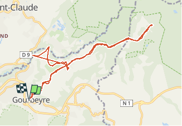

Length
17.1 km

Max alt
715 m

Uphill gradient
716 m
Km-Effort
27 km

Min alt
341 m

Downhill gradient
710 m
Boucle
Yes
Creation date :
2020-11-08 13:34:56.0
Updated on :
2020-11-08 16:29:03.701
2h10
Difficulty : Difficult

FREE GPS app for hiking
 SityTrail
IGN / Geographical institutes
SityTrail Plus
The world is yours!
About
Trail Trail of 17.1 km to be discovered at Guadeloupe, Unknown, Gourbeyre. This trail is proposed by sameja.
Description
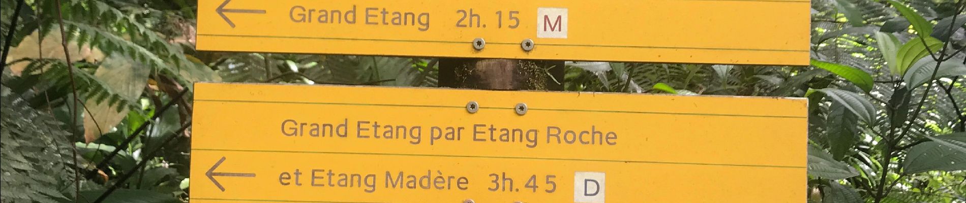
Palmiste
Photos


Positioning
Country:
France
Region :
Guadeloupe
Department/Province :
Unknown
Municipality :
Gourbeyre
Location:
Unknown
Start:(Dec)
Start:(UTM)
639904 ; 1768787 (20P) N.
Comments