


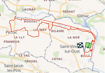
18/11/2020 - De ST VINCENT S/OUST à PEILLAC.Virtuel

babeth35
User

Length
29 km

Max alt
68 m

Uphill gradient
474 m
Km-Effort
36 km

Min alt
1 m

Downhill gradient
468 m
Boucle
Yes
Creation date :
2020-11-18 14:05:40.753
Updated on :
2020-11-18 15:49:05.586
--
Difficulty : Medium
48m
Difficulty : Easy

FREE GPS app for hiking
 SityTrail
IGN / Geographical institutes
SityTrail Plus
The world is yours!
About
Trail On foot of 29 km to be discovered at Brittany, Morbihan, Saint-Vincent-sur-Oust. This trail is proposed by babeth35.
Positioning
Country:
France
Region :
Brittany
Department/Province :
Morbihan
Municipality :
Saint-Vincent-sur-Oust
Location:
Unknown
Start:(Dec)
Start:(UTM)
565113 ; 5283033 (30T) N.
Comments