


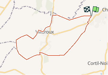
SityTrail - P5904 Villeroux 066

vindju
User

Length
8.6 km

Max alt
152 m

Uphill gradient
92 m
Km-Effort
9.8 km

Min alt
115 m

Downhill gradient
93 m
Boucle
Yes
Creation date :
2020-11-22 09:44:10.812
Updated on :
2021-03-08 08:12:54.91
2h07
Difficulty : Medium

FREE GPS app for hiking
 SityTrail
IGN / Geographical institutes
SityTrail Plus
The world is yours!
About
Trail Walking of 8.6 km to be discovered at Wallonia, Walloon Brabant, Chastre. This trail is proposed by vindju.


Positioning
Country:
Belgium
Region :
Wallonia
Department/Province :
Walloon Brabant
Municipality :
Chastre
Location:
Chastre-Villeroux-Blanmont
Start:(Dec)
Start:(UTM)
615579 ; 5607508 (31U) N.
Comments