


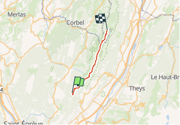
Chartreuse: Chalet Pleynon à Chalet de l'Alpe

MathieuBourgois
User

Length
21 km

Max alt
1887 m

Uphill gradient
1234 m
Km-Effort
36 km

Min alt
1308 m

Downhill gradient
892 m
Boucle
No
Creation date :
2020-11-23 13:04:07.604
Updated on :
2020-11-23 13:05:21.546
--
Difficulty : Medium

FREE GPS app for hiking
 SityTrail
IGN / Geographical institutes
SityTrail Plus
The world is yours!
About
Trail On foot of 21 km to be discovered at Auvergne-Rhône-Alpes, Isère, Saint-Pierre-de-Chartreuse. This trail is proposed by MathieuBourgois.
Description
Source près du chalet de l'Alpe
21km et 1234D
Positioning
Country:
France
Region :
Auvergne-Rhône-Alpes
Department/Province :
Isère
Municipality :
Saint-Pierre-de-Chartreuse
Location:
Unknown
Start:(Dec)
Start:(UTM)
720851 ; 5019363 (31T) N.
Comments