


20201126 Ser 1km

Childebert
User
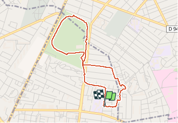

Length
3.9 km

Max alt
52 m

Uphill gradient
34 m
Km-Effort
4.4 km

Min alt
30 m

Downhill gradient
33 m
Boucle
Yes
Creation date :
2020-11-26 12:25:53.632
Updated on :
2020-11-26 13:28:46.182
1h00
Difficulty : Easy

FREE GPS app for hiking
 SityTrail
IGN / Geographical institutes
SityTrail Plus
The world is yours!
About
Trail Walking of 3.9 km to be discovered at Normandy, Seine-Maritime, Saint-Étienne-du-Rouvray. This trail is proposed by Childebert.
Positioning
Country:
France
Region :
Normandy
Department/Province :
Seine-Maritime
Municipality :
Saint-Étienne-du-Rouvray
Location:
Unknown
Start:(Dec)
Start:(UTM)
360587 ; 5473584 (31U) N.
Comments