


roque Négade chemin de ronde

elexine23
User
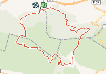

Length
13.8 km

Max alt
481 m

Uphill gradient
576 m
Km-Effort
21 km

Min alt
118 m

Downhill gradient
569 m
Boucle
Yes
Creation date :
2020-11-29 07:59:48.562
Updated on :
2020-11-29 14:03:25.699
5h05
Difficulty : Easy

FREE GPS app for hiking
 SityTrail
IGN / Geographical institutes
SityTrail Plus
The world is yours!
About
Trail Walking of 13.8 km to be discovered at Occitania, Aude, Barbaira. This trail is proposed by elexine23.
Description
.
Positioning
Country:
France
Region :
Occitania
Department/Province :
Aude
Municipality :
Barbaira
Location:
Unknown
Start:(Dec)
Start:(UTM)
461429 ; 4780286 (31T) N.
Comments