


Chartreuse Chamechaude par télésiège

c.gourme
User
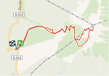

Length
7.1 km

Max alt
2040 m

Uphill gradient
773 m
Km-Effort
17.5 km

Min alt
1260 m

Downhill gradient
775 m
Boucle
Yes
Creation date :
2020-12-03 07:32:16.0
Updated on :
2020-12-03 11:30:42.445
3h31
Difficulty : Medium

FREE GPS app for hiking
 SityTrail
IGN / Geographical institutes
SityTrail Plus
The world is yours!
About
Trail Walking of 7.1 km to be discovered at Auvergne-Rhône-Alpes, Isère, Sarcenas. This trail is proposed by c.gourme.
Positioning
Country:
France
Region :
Auvergne-Rhône-Alpes
Department/Province :
Isère
Municipality :
Sarcenas
Location:
Unknown
Start:(Dec)
Start:(UTM)
716934 ; 5018030 (31T) N.
Comments