


villelaure

mhetpierre
User
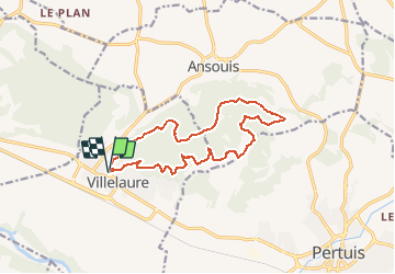

Length
15 km

Max alt
392 m

Uphill gradient
413 m
Km-Effort
21 km

Min alt
182 m

Downhill gradient
414 m
Boucle
Yes
Creation date :
2020-12-05 18:11:42.287
Updated on :
2020-12-05 18:15:32.651
--
Difficulty : Easy

FREE GPS app for hiking
 SityTrail
IGN / Geographical institutes
SityTrail Plus
The world is yours!
About
Trail On foot of 15 km to be discovered at Provence-Alpes-Côte d'Azur, Vaucluse, Villelaure. This trail is proposed by mhetpierre.
Positioning
Country:
France
Region :
Provence-Alpes-Côte d'Azur
Department/Province :
Vaucluse
Municipality :
Villelaure
Location:
Unknown
Start:(Dec)
Start:(UTM)
695857 ; 4842917 (31T) N.
Comments