


J1 ONGLES FONTAINE

ophness
User
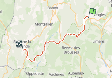

Length
21 km

Max alt
711 m

Uphill gradient
505 m
Km-Effort
28 km

Min alt
499 m

Downhill gradient
520 m
Boucle
No
Creation date :
2020-12-08 09:48:23.355
Updated on :
2021-04-30 12:28:58.123
4h27
Difficulty : Difficult

FREE GPS app for hiking
 SityTrail
IGN / Geographical institutes
SityTrail Plus
The world is yours!
About
Trail Horseback riding of 21 km to be discovered at Provence-Alpes-Côte d'Azur, Alpes-de-Haute-Provence, Ongles. This trail is proposed by ophness.
Positioning
Country:
France
Region :
Provence-Alpes-Côte d'Azur
Department/Province :
Alpes-de-Haute-Provence
Municipality :
Ongles
Location:
Unknown
Start:(Dec)
Start:(UTM)
717097 ; 4877829 (31T) N.
Comments