


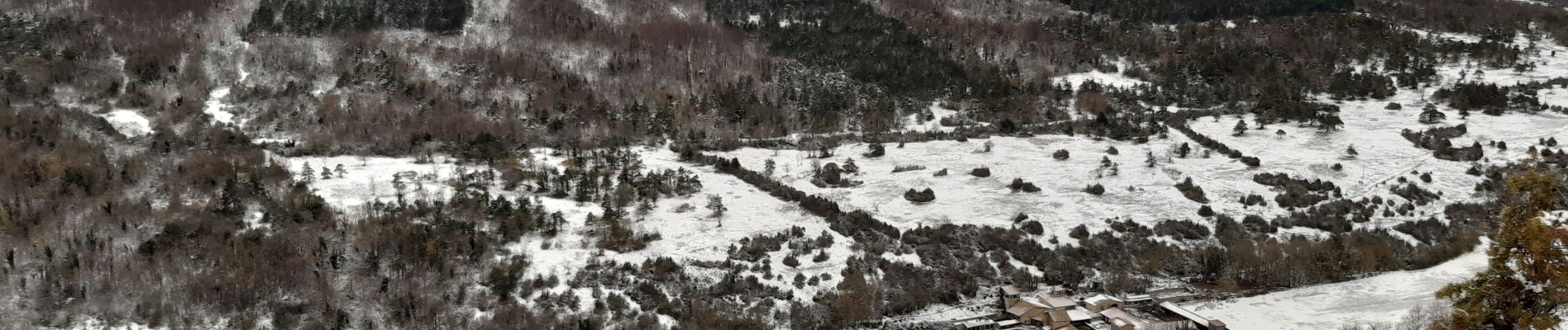
la rivière.gigors.lozeron.

Joel26400
User
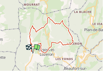

Length
18.1 km

Max alt
922 m

Uphill gradient
810 m
Km-Effort
29 km

Min alt
405 m

Downhill gradient
809 m
Boucle
Yes
Creation date :
2020-12-10 07:43:26.473
Updated on :
2020-12-10 14:47:20.414
7h02
Difficulty : Easy

FREE GPS app for hiking
 SityTrail
IGN / Geographical institutes
SityTrail Plus
The world is yours!
About
Trail Walking of 18.1 km to be discovered at Auvergne-Rhône-Alpes, Drôme, Gigors-et-Lozeron. This trail is proposed by Joel26400.
Description
super avec la neige
Photos

Positioning
Country:
France
Region :
Auvergne-Rhône-Alpes
Department/Province :
Drôme
Municipality :
Gigors-et-Lozeron
Location:
Unknown
Start:(Dec)
Start:(UTM)
665402 ; 4961973 (31T) N.
Comments