


Serres 84

aupi
User
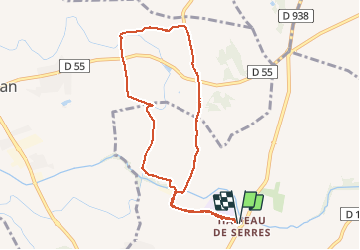

Length
8.8 km

Max alt
109 m

Uphill gradient
60 m
Km-Effort
9.6 km

Min alt
78 m

Downhill gradient
60 m
Boucle
Yes
Creation date :
2020-12-10 13:22:53.291
Updated on :
2020-12-10 16:01:58.41
2h12
Difficulty : Easy

FREE GPS app for hiking
 SityTrail
IGN / Geographical institutes
SityTrail Plus
The world is yours!
About
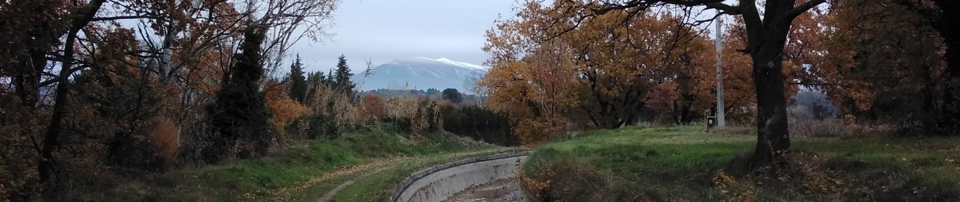
Trail Walking of 8.8 km to be discovered at Provence-Alpes-Côte d'Azur, Vaucluse, Carpentras. This trail is proposed by aupi.
Photos


Positioning
Country:
France
Region :
Provence-Alpes-Côte d'Azur
Department/Province :
Vaucluse
Municipality :
Carpentras
Location:
Unknown
Start:(Dec)
Start:(UTM)
665591 ; 4883081 (31T) N.
Comments
Beaucoup de route. De jolis endroits.