


sur les traces de Manon-Signes-18-12-20

Christiancordin
User

Length
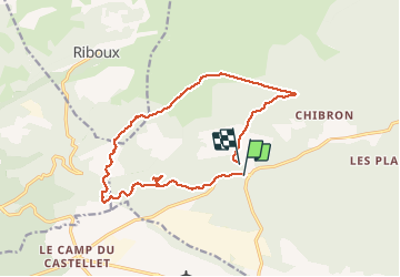
16 km

Max alt
561 m

Uphill gradient
285 m
Km-Effort
19.8 km

Min alt
362 m

Downhill gradient
294 m
Boucle
No
Creation date :
2020-12-18 08:56:27.378
Updated on :
2020-12-18 17:05:35.118
4h42
Difficulty : Medium

FREE GPS app for hiking
 SityTrail
IGN / Geographical institutes
SityTrail Plus
The world is yours!
About
Trail Walking of 16 km to be discovered at Provence-Alpes-Côte d'Azur, Var, Signes. This trail is proposed by Christiancordin.
Description
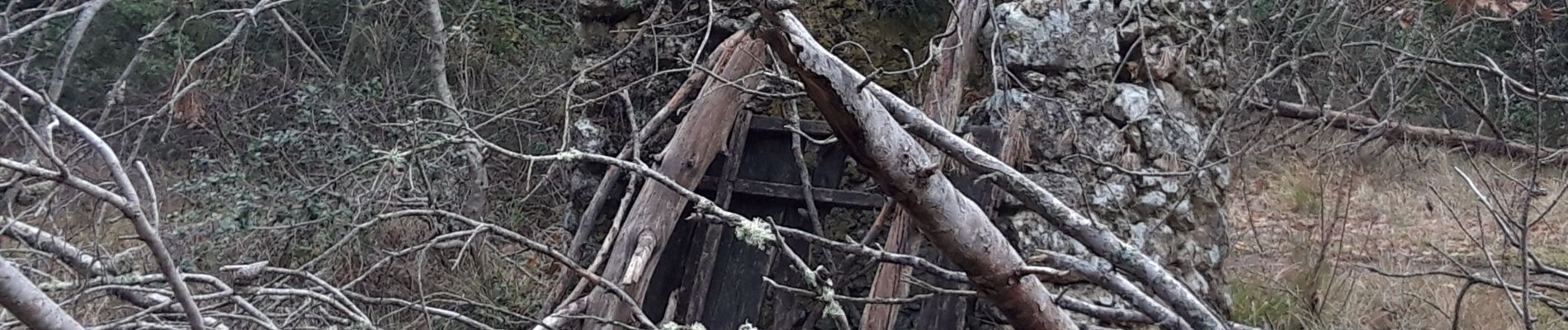
vallon des Marseillais-ruine du Mounoï-grotte du Mounoï-mémorial de Signes-torrent asséché-bastide Château Renard-plaine du romanil
Photos


Positioning
Country:
France
Region :
Provence-Alpes-Côte d'Azur
Department/Province :
Var
Municipality :
Signes
Location:
Unknown
Start:(Dec)
Start:(UTM)
727407 ; 4795194 (31T) N.
Comments