


Wikiloc - Belgentier

affinetataille
User GUIDE
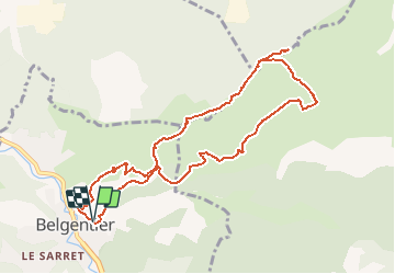

Length
10.7 km

Max alt
620 m

Uphill gradient
574 m
Km-Effort
18.3 km

Min alt
162 m

Downhill gradient
577 m
Boucle
Yes
Creation date :
2020-12-19 09:26:07.262
Updated on :
2020-12-22 21:05:14.42
5h00
Difficulty : Medium

FREE GPS app for hiking
 SityTrail
IGN / Geographical institutes
SityTrail Plus
The world is yours!
About
Trail Walking of 10.7 km to be discovered at Provence-Alpes-Côte d'Azur, Var, Belgentier. This trail is proposed by affinetataille.
Description
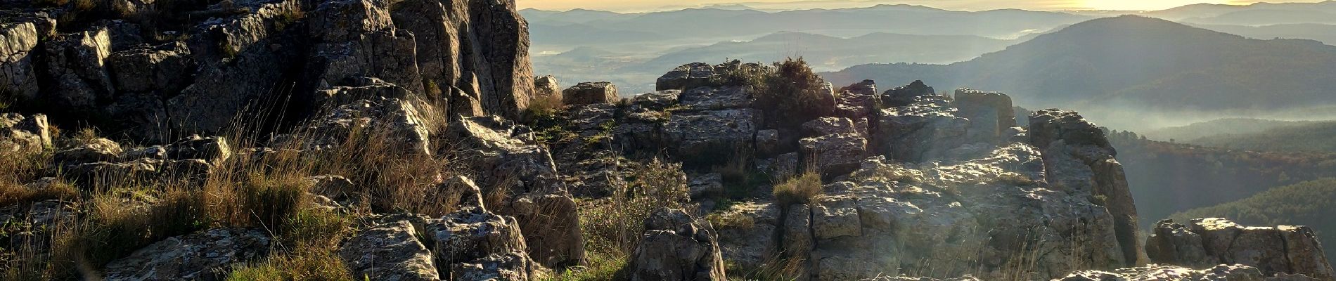
Belle rando sans grandes difficultés avec des points de vues magnifiques ...
Photos


29 photos in total. Please click on a photo to see them all in the gallery.
Positioning
Country:
France
Region :
Provence-Alpes-Côte d'Azur
Department/Province :
Var
Municipality :
Belgentier
Location:
Unknown
Start:(Dec)
Start:(UTM)
256709 ; 4792446 (32T) N.
Comments
Vraiment de très belles photos ! Bravo !