


orcieres

gillesmanfredi
User
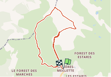

Length
12.9 km

Max alt
2634 m

Uphill gradient
1187 m
Km-Effort
29 km

Min alt
1821 m

Downhill gradient
1191 m
Boucle
Yes
Creation date :
2020-12-19 08:48:09.258
Updated on :
2020-12-19 12:57:23.113
4h08
Difficulty : Very easy

FREE GPS app for hiking
 SityTrail
IGN / Geographical institutes
SityTrail Plus
The world is yours!
About
Trail Touring skiing of 12.9 km to be discovered at Provence-Alpes-Côte d'Azur, Hautes-Alpes, Orcières. This trail is proposed by gillesmanfredi.
Positioning
Country:
France
Region :
Provence-Alpes-Côte d'Azur
Department/Province :
Hautes-Alpes
Municipality :
Orcières
Location:
Unknown
Start:(Dec)
Start:(UTM)
287850 ; 4952817 (32T) N.
Comments