


repérage VTT

bernardcornu
User
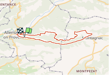

Length
18.8 km

Max alt
618 m

Uphill gradient
298 m
Km-Effort
23 km

Min alt
422 m

Downhill gradient
297 m
Boucle
Yes
Creation date :
2020-12-22 09:38:20.311
Updated on :
2020-12-22 11:39:41.094
1h44
Difficulty : Easy

FREE GPS app for hiking
 SityTrail
IGN / Geographical institutes
SityTrail Plus
The world is yours!
About
Trail Mountain bike of 18.8 km to be discovered at Provence-Alpes-Côte d'Azur, Alpes-de-Haute-Provence, Allemagne-en-Provence. This trail is proposed by bernardcornu.
Positioning
Country:
France
Region :
Provence-Alpes-Côte d'Azur
Department/Province :
Alpes-de-Haute-Provence
Municipality :
Allemagne-en-Provence
Location:
Unknown
Start:(Dec)
Start:(UTM)
260058 ; 4851732 (32T) N.
Comments