


Wachtebeke-Moerbeke • Smokkelruiterroute • bruine lus

eddyvermeulen1
User
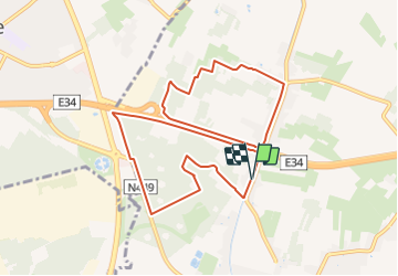

Length
9.3 km

Max alt
20 m

Uphill gradient
53 m
Km-Effort
10 km

Min alt
0 m

Downhill gradient
53 m
Boucle
Yes
Creation date :
2020-12-25 18:37:06.153
Updated on :
2022-03-18 17:13:40.58
1h18
Difficulty : Easy

FREE GPS app for hiking
 SityTrail
IGN / Geographical institutes
SityTrail Plus
The world is yours!
About
Trail Horseback riding of 9.3 km to be discovered at Flanders, East Flanders, Wachtebeke. This trail is proposed by eddyvermeulen1.


Positioning
Country:
Belgium
Region :
Flanders
Department/Province :
East Flanders
Municipality :
Wachtebeke
Location:
Unknown
Start:(Dec)
Start:(UTM)
559677 ; 5670757 (31U) N.
Comments