Le Thaurac

nadinebondoux
User GUIDE
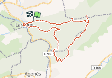

Length
11.4 km

Max alt
480 m

Uphill gradient
427 m
Km-Effort
17.1 km

Min alt
138 m

Downhill gradient
424 m
Boucle
Yes
Creation date :
2020-12-26 09:14:04.452
Updated on :
2020-12-27 18:17:49.507
4h41
Difficulty : Medium

FREE GPS app for hiking
 SityTrail
IGN / Geographical institutes
SityTrail Plus
The world is yours!
About
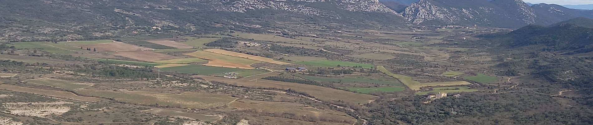
Trail Walking of 11.4 km to be discovered at Occitania, Hérault, Laroque. This trail is proposed by nadinebondoux.
Description
au départ de Laroque
Photos


21 photos in total. Please click on a photo to see them all in the gallery.
Positioning
Country:
France
Region :
Occitania
Department/Province :
Hérault
Municipality :
Laroque
Location:
Unknown
Start:(Dec)
Start:(UTM)
558462 ; 4863642 (31T) N.
Comments