


la Faucille - Les Rousses

svp59
User
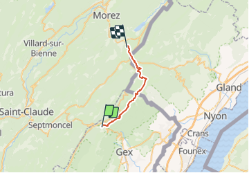

Length
21 km

Max alt
1669 m

Uphill gradient
741 m
Km-Effort
31 km

Min alt
1105 m

Downhill gradient
942 m
Boucle
No
Creation date :
2014-12-10 00:00:00.0
Updated on :
2014-12-10 00:00:00.0
6h40
Difficulty : Difficult

FREE GPS app for hiking
 SityTrail
IGN / Geographical institutes
SityTrail Plus
The world is yours!
About
Trail Walking of 21 km to be discovered at Auvergne-Rhône-Alpes, Ain, Gex. This trail is proposed by svp59.
Positioning
Country:
France
Region :
Auvergne-Rhône-Alpes
Department/Province :
Ain
Municipality :
Gex
Location:
Unknown
Start:(Dec)
Start:(UTM)
270431 ; 5139198 (32T) N.
Comments