


Nevache

GOHIER
User

Length
9.9 km

Max alt
1844 m

Uphill gradient
287 m
Km-Effort
13.7 km

Min alt
1602 m

Downhill gradient
286 m
Boucle
Yes
Creation date :
2020-12-30 10:25:04.0
Updated on :
2020-12-30 13:59:06.193
3h31
Difficulty : Unknown

FREE GPS app for hiking
 SityTrail
IGN / Geographical institutes
SityTrail Plus
The world is yours!
About
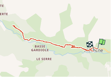
Trail Touring skiing of 9.9 km to be discovered at Provence-Alpes-Côte d'Azur, Hautes-Alpes, Névache. This trail is proposed by GOHIER.
Description
Route mais paysage sublime. Moins 10 degres!
Positioning
Country:
France
Region :
Provence-Alpes-Côte d'Azur
Department/Province :
Hautes-Alpes
Municipality :
Névache
Location:
Unknown
Start:(Dec)
Start:(UTM)
311417 ; 4987908 (32T) N.
Comments