


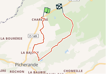
picherande 31/01/2020

dudu79
User

Length
6.2 km

Max alt
1267 m

Uphill gradient
163 m
Km-Effort
8.2 km

Min alt
1118 m

Downhill gradient
113 m
Boucle
No
Creation date :
2020-12-31 11:40:46.181
Updated on :
2021-01-01 11:56:41.144
1h50
Difficulty : Very easy

FREE GPS app for hiking
 SityTrail
IGN / Geographical institutes
SityTrail Plus
The world is yours!
About
Trail Walking of 6.2 km to be discovered at Auvergne-Rhône-Alpes, Puy-de-Dôme, Picherande. This trail is proposed by dudu79.
Description
rando Auvergne 2020/2021
Photos

Positioning
Country:
France
Region :
Auvergne-Rhône-Alpes
Department/Province :
Puy-de-Dôme
Municipality :
Picherande
Location:
Unknown
Start:(Dec)
Start:(UTM)
482770 ; 5036730 (31T) N.
Comments