


Le signal de l'alaric

F.Rioland
User

Length
24 km

Max alt
597 m

Uphill gradient
568 m
Km-Effort
32 km

Min alt
48 m

Downhill gradient
619 m
Boucle
No
Creation date :
2021-01-01 13:05:05.962
Updated on :
2021-01-01 16:48:04.016
3h37
Difficulty : Medium

FREE GPS app for hiking
 SityTrail
IGN / Geographical institutes
SityTrail Plus
The world is yours!
About
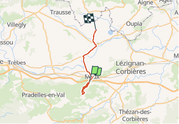
Trail Walking of 24 km to be discovered at Occitania, Aude, Moux. This trail is proposed by F.Rioland.
Description
superbe
Photos


Positioning
Country:
France
Region :
Occitania
Department/Province :
Aude
Municipality :
Moux
Location:
Unknown
Start:(Dec)
Start:(UTM)
470952 ; 4779923 (31T) N.
Comments