


Rocher brûlé

Yannick.Boireau
User
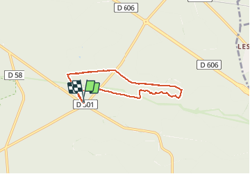

Length
5.7 km

Max alt
113 m

Uphill gradient
49 m
Km-Effort
6.4 km

Min alt
82 m

Downhill gradient
48 m
Boucle
Yes
Creation date :
2021-01-03 13:37:43.513
Updated on :
2021-01-03 15:25:33.369
1h47
Difficulty : Very easy

FREE GPS app for hiking
 SityTrail
IGN / Geographical institutes
SityTrail Plus
The world is yours!
About
Trail Walking of 5.7 km to be discovered at Ile-de-France, Seine-et-Marne, Fontainebleau. This trail is proposed by Yannick.Boireau.
Photos


Positioning
Country:
France
Region :
Ile-de-France
Department/Province :
Seine-et-Marne
Municipality :
Fontainebleau
Location:
Unknown
Start:(Dec)
Start:(UTM)
480691 ; 5358237 (31U) N.
Comments