


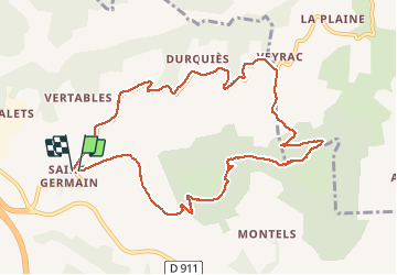
st germain pic d andan Veyrac st g

lablaquiere
User

Length
11.1 km

Max alt
883 m

Uphill gradient
433 m
Km-Effort
16.9 km

Min alt
548 m

Downhill gradient
431 m
Boucle
Yes
Creation date :
2021-01-04 14:18:55.362
Updated on :
2021-01-04 16:30:00.921
2h10
Difficulty : Very easy

FREE GPS app for hiking
 SityTrail
IGN / Geographical institutes
SityTrail Plus
The world is yours!
About
Trail Walking of 11.1 km to be discovered at Occitania, Aveyron, Millau. This trail is proposed by lablaquiere.
Positioning
Country:
France
Region :
Occitania
Department/Province :
Aveyron
Municipality :
Millau
Location:
Unknown
Start:(Dec)
Start:(UTM)
503143 ; 4887184 (31T) N.
Comments